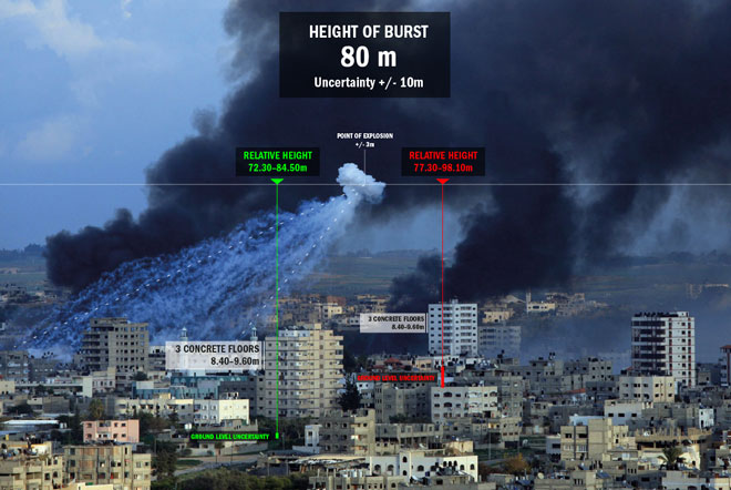
In this section, the interplay between a single M825 WP round and a given built environment is examined at the scale of an urban neighborhood. This examination proceeds according to the following steps:
- Photographic and video documentation of M825 WP rounds is analyzed: the initial parameters necessary to model and simulate the ballistic behavior of the projectile are identified; and a range of values for these parameters is established using data cited in military documents or through the analysis of verifiably-sourced images.
- A computer-assisted simulation model is constructed accordingly. Once the initial parameters are set, the model simulates the dispersal of the 116 wedges until they intersect with the ground. The resulting Coverage Area is then identified and measured. Several simulations are run and a range of values for the Coverage Area of the M825 WP is established.
- Typical WP Coverage Areas are mapped onto the built environment of a series of different urban neighborhoods. When set against the demographic statistics of and the distribution of structures within a given neighborhood, the resulting Coverage Area provides a metric from which to evaluate the extent of the civilian exposure resulting from a single M825 WP round.
